Conewago Creek Floodplain Restoration
| MS4 communities Londonderry and Mt. Joy townships needed to find a way to reduce sediment and nutrient pollution entering Conewago Creek. For this project, the township served as the lead and, along with their engineer-of-record, HRG Inc., recruited LandStudies to develop a floodplain restoration strategy that earned a Dauphin County Premier Project Award for 2021 by the Tri-County Regional Planning Commission.
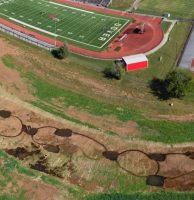
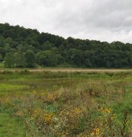
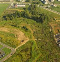
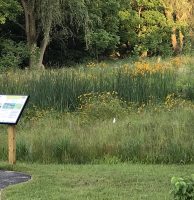
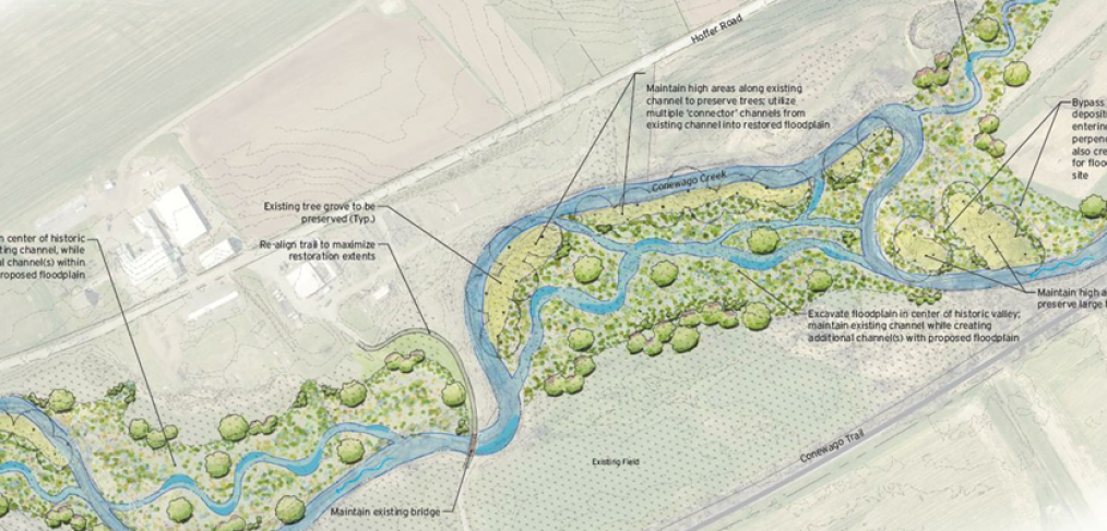
LandStudies designed, engineered, and provided permitting support for the 15.2-acre floodplain restoration. The design replicates evidenced historical conditions by removing 125,000 cubic yards of legacy sediment along a nearly 6,400-foot-long section of the creek and its tributary, Brills Run. The restoration will result in load reductions of 10,624 lbs/yr Total Nitrogen, 3,567 lbs/yr Total Phosphorus, and 1.2 million lbs/yr Total Suspended Sediment, which will help the townships meet the obligations of their Pollutant Reduction Plans while also creating an aesthetically pleasing and ecologically sound landscape. This project is located adjacent to the popular Conewago Trail and the Schmidt Tract, a 155-acre farm that will be preserved and converted to natural open space by the Lancaster Conservancy. Once completed, the floodplain restoration will provide a unique opportunity to showcase innovative land management strategies and floodplain restoration to thousands of hikers and bikers who enjoy the trail and preserve. ServicesGreen Master Plan | Assessment | Design | Engineering | Permitting Construction on Phase I is scheduled to begin in 2023 Client: Londonderry Township Location: Londonderry Township, Dauphin County, PA Mt. Joy Township, Lancaster County, PA |
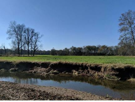 Pre-construction 6-foot-high eroding bank with historic floodplain layer under legacy sediment 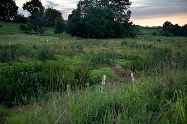 Proposed future conditions after restoration
|