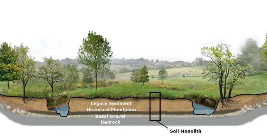
Soil Monolith – A sample of soil with an undisturbed structure used to show layers and textures.
Legacy sediment is so prevalent in many regions that it has become invisible to most people. These thick sediment deposits have changed streams and valleys so much that the historical condition of a floodplain is often unrecognizable and inaccessible.
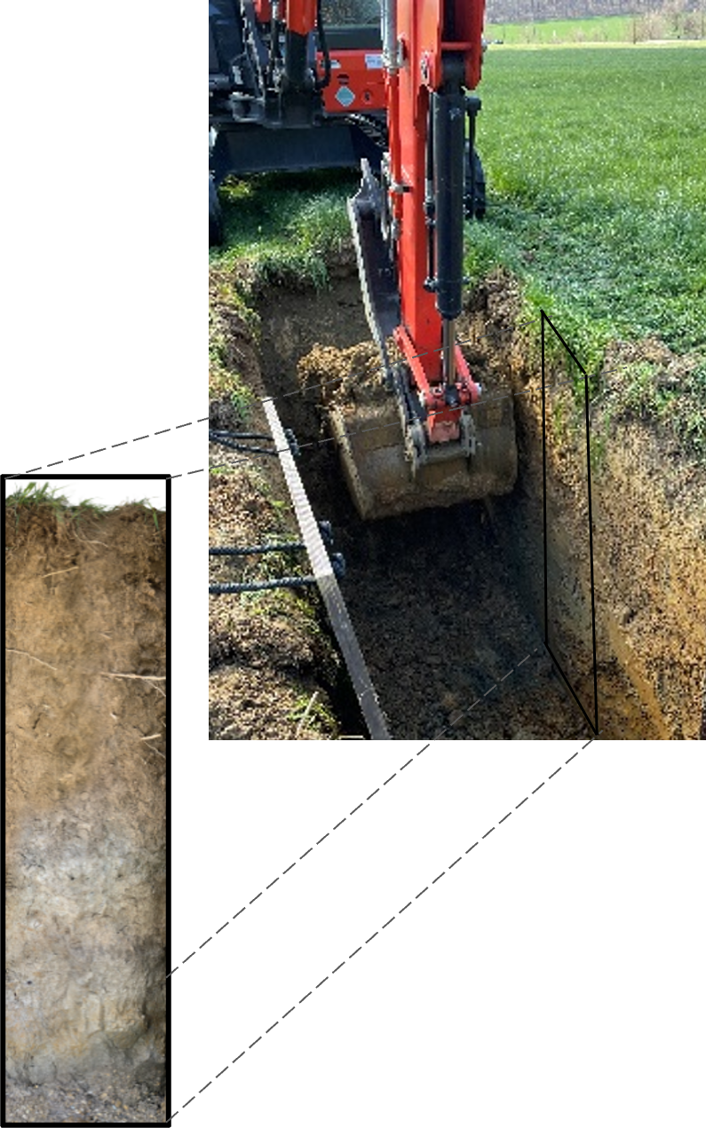
Digging a trench to view soil profile.
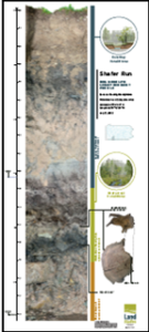
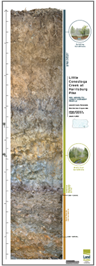
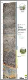
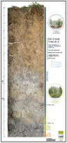
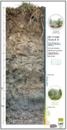
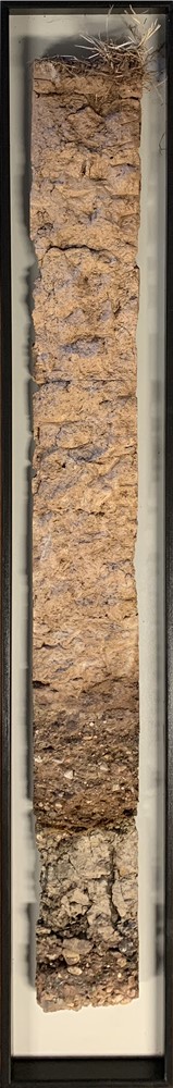
LandStudies has developed many diverse types of visual aids and infographics over the past 30 years to illustrate the concepts around legacy sediment. Recently, we began collecting soil monoliths from our projects to provide a slice of the soil profile that is usually difficult to observe. Each monolith is a full-scale composite photograph of a trench wall that is dug in the floodplain next to the stream channel. The layers visible in each profile can tell the story of conditions at that very location today and as far back as 10,000 years ago or more.
The layers in the digital monoliths are labeled, along with radiocarbon dates to illustrate the age at certain locations. Each digital monolith was designed to visually tell the story of legacy sediment in a simple and concise illustration. These digital monoliths can be downloaded and printed in high-resolution and at full scale.
Click on the thumbnail images below for a full-sized PDF of these soil profiles: